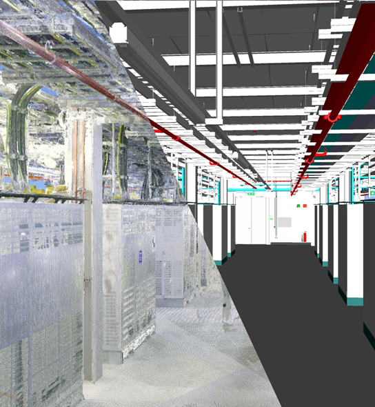

Geospatial modelling involves the use of laser scanners to generate pinpoint accurate 3D point cloud data of an area.
For our BIM (Building Information Modelling) teams, this technology allows them to stay on top of potential issues or clashes between our designs, models, and the reality on site.
Winthrop have now developed our own in-house geospatial scanning capabilities.
On one of our Dublin DC projects, BIM teams have begun using the cutting-edge terrestrial laser scanner in their work. Having our own in-house tools gives us greater control and flexibility when it comes to the frequency and accuracy of our scans.
By scheduling scans at critical stages throughout the project schedule, we can ensure that up-to-date and accurate information of what’s installed on site is fed back to our BIM team and any potential clashes or issues with future installs are identified before they arrive on site.
This in turn means we can be 100% confident in the accuracy of our BIM models compared to what’s been installed, ensuring the highest level of quality as projects develop and grow.